After experiencing a small part of Outback Queensland, I feel obliged to reinstate my support for domestic travel, and feel that the Aussie outback needs more of our patronage as visitors, not just for our enjoyment but also to help their local economy. In one of my past posts, I had made some points in relation to travelling in Australia before considering overseas destinations. There are many destinations out there that are yet to be widely publicised, but many that are dying for tourism dollars. Populations are spiralling downwards and there seems to be no end to an economic black hole. Motorcycling adventures might be the answer to declining rural economies.
Where there are more visitors, the local economy grows with it. Due to the lack of storage options compared to a car, a motorcyclist is far more likely to step into a local shop to obtain their sources of accommodation, food, drinks and supplies for the road ahead of them. Take a look at some of the more popular motorcycling roads in the middle of whoop whoop. Cafes, restaurants and servos are often lined with motorcycles along the road beside them.
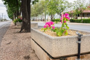
For example, take a look at the Old Pacific Highway, between Calga (near Gosford) and Berowra (within Sydney’s northern metropolitan area). The road as we know it is the most popular destination for motorcyclists and car enthusiasts in Sydney, where hundreds of keen riders and drivers roam “The Old Road” every weekend. One thing is obvious that makes it a favourite among many: its close proximity to many Sydneysiders. This makes it, more often than not, the #1 choice for anyone who are looking for a good Sunday ride through winding roads.
Let’s just briefly take out the enjoyable twisties of The Old Road out of the whole equation: the road is just a backroad running almost parallel to the F3 Motorway that allows motorists to bypass the small towns of Cowan, Mooney Mooney and Mt White. The majority of motorists use the F3 Motorway to commute between Gosford/Newcastle and Sydney and, effectively, those towns are not given a second glance to your usual Joneses. Apart from the views and water activities offered by the riverside Brooklyn and Mooney Mooney suburbs, I am hard-pressed to highlight any remarkable attractions along the majority of the route.
Despite the lack of non-riding and driving attractions, The Old Road has been bringing in consistent stream of visitors for decades, and this is most discernable when you roll in to the two rider-friendly cafes: Pie in the Sky (on the Brooklyn side) and Road Warriors Cafe (in Mount White). These thriving local businesses are a testament to the popularity of the area amongst motor enthusiasts. When businesses are successfully pulling in a consistent level of patronage and healthy cashflow, this can only be a significant positive for the local economy.
I call upon Australian motorcyclists to seriously consider a moto-adventure of their own in regional Australia. There’s an abundance of sceneries to capture in your memories and, if you’ve never stepped foot out of your city, you will never see Australia the same way after your time in the surrounds of a peaceful and uniquely-Australian landscape. It’s time that we’ve stopped accepting the Outback just as an image of a postage stamp, whilst lamenting the lack of travel destinations in our country. It’s time that we’ve hit the road and start supporting our mates in Australia’s backyard.
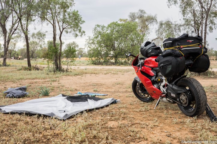
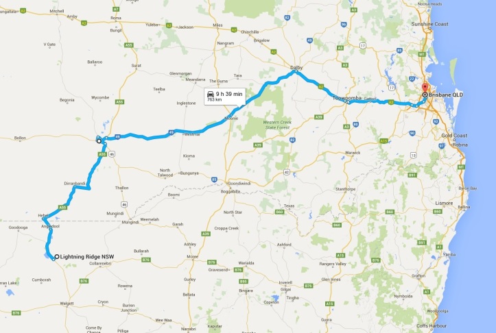
I think maybe, just maybe, I had spent too much of a relaxing time in the hot bath the night before, that I had unintentionally overslept. My schedule had to be pushed forward 3 hours, and this effectively meant that I could not make it to the Sunshine Coast and set up for another night camping in the tent.
The Sunshine Coast was chosen originally as my next camping spot due to favourably dry conditions forecasted for the following day, whereas the regions anywhere south from that region were to be affected by overnight rain. Reluctantly, Plan-B was to make it to Brisbane and stay in hostel accommodation.

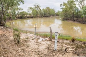
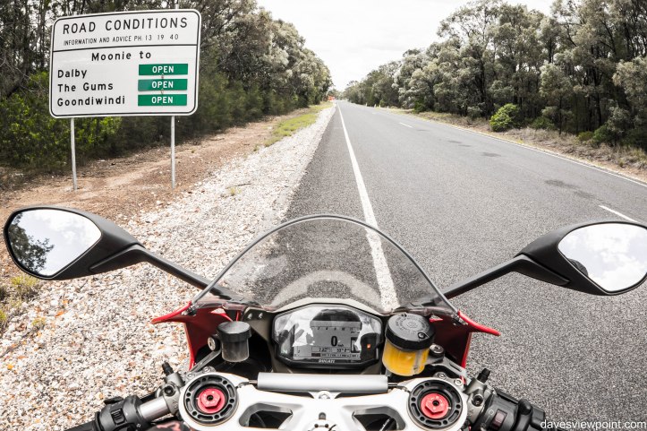
As I departed the town of Lightning Ridge, rain clouds progressively formed above the roads that led in the direction of Hebel, located 4kms north of the NSW/QLD border, the first town that I would visit in outback Queensland. Eventually, the rain did mark its fall, but only for a very brief moment. Due to the hot weather, you would be hard pressed to tell that it had even rained as any signs of water would be swallowed up by the arid fields. Think of the rain out here like a drop of water into a child’s sandpit.
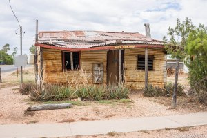
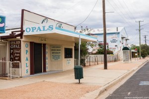
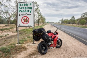
The best thing (at least from a tourist’s perspective) about rain in the Australian outback is that any rainfall is very short-lived and is unlikely to hinder you from hosting any outdoor activities. Unfortunately, the Balonne Shire that covers the Hebel and St George district is one of the many drought-affected parts of Queensland whose industry and livelihoods are constantly under pressure from the lack of beneficial rainfall. According to this local news article, there are only 50 residents in Hebel at most, a far cry from the 150 according to the 2006 census. As long as the dry spell hinders local productivity, there is no chance that this population figure would improve at all in the future.
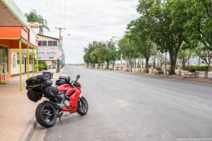
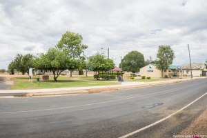
Dirranbandi was my next rest stop, where industry relies heavily on the cotton harvest season between November and January. Apparently, the usual 700-person population figure booms during this time, as short-term harvest workers flow into the district. In saying that, the town still seemed like a ghost town, with just one or two other people walking past.
As the hours went by, whilst the odometer figure climbed up like the minutes of a digital clock, the landscape evolved from a barren aridness to fields of golden agriculture under cloudy skies, where fields of cut wheat abounded my vision from left to right, divided by the never-ending stretch of asphalt ahead of me like a scenic centrefold.


If you are familiar with at least parts of regional Australia, you may notice that many of the servos that are located in the sticks are unmanned petrol stations. Instead of a shop attendant to accept your payment, you would be dealing with a payment machine that requires you to swipe your card first before filling up. The bowsers themselves look very much the same as any conventional one, as you can see from the above image mosaic which was taken at BP St George. As long as you have enough funds in your account for the required fuel amount, there would be no issues with the fuel purchase. For the outback environment, I have absolutely no faults for it; better than having no fuel at all.
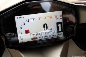
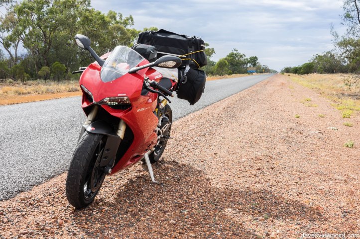
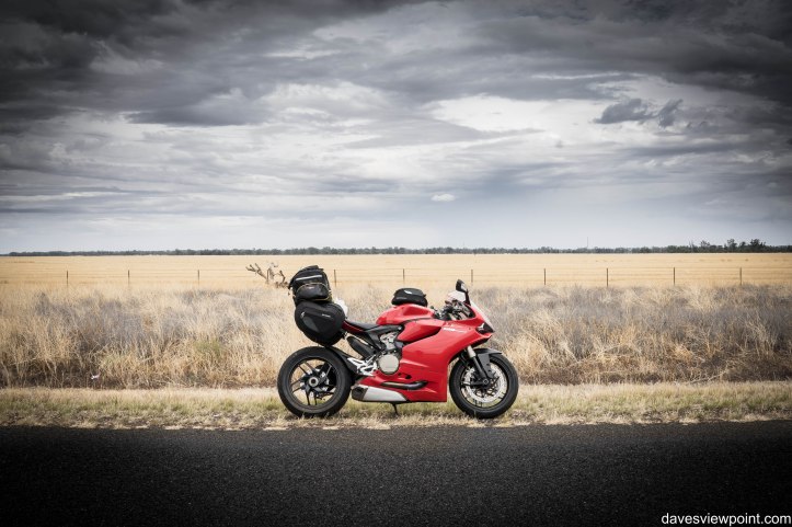
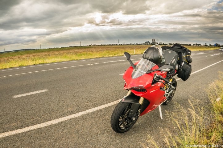
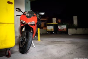
I’ve also come to discover that my Panigale can be taken over a distance of above 220km. The trip meter displayed 236km, counting from the previous fill, right up to where I had to surrender for a re-fuel at St George. My usual distance covered for a tank is usually around the 170km before the low-fuel indicator flashes, and the maximum distance after the light turns on is around 30kms before the bike dies (I know.. I’ve tried it once!), so it’s great to know that the bike can do a little more than I believe that it can achieve. In saying that, the route that I had travelled was predominantly a flat, open highway without many stops or abrupt acceleration, which is really the best way to achieve maximum fuel economy. I always carry around spare fuel to the amount of 5L wherever I go in a long trip for peace of mind in case a servo ends up being one that’s been closed or abandoned.


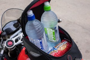
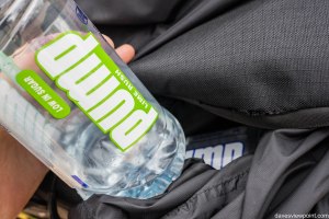
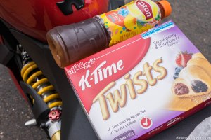
Westmar was one locality that I had stopped for my drink break. I’m always one to find ways to improvise on the things I have in hand. One realisation that I had come across is that your thermal lining can also be used like an esky of sorts. Wrapping a cold drink, like the bottle of Lipton tea that I had purchased at Dirranbandi from 2 hours before I had to take another sip, allowed it to maintain a good chill level on a hot 35°C day. No, it’s not going to be fridge-cool, but a drink standing at room temperature is always going to be much better than drinking a lukewarm sugary beverage.
Cornfields are in huge abundance around the region between Dalby to Toowoomba, as seen in the slideshow above. Corn and cotton are two crops that are widely harvested in this area. In one particular example, as shown in this local news article, corn can be grown on cotton fields from the previous year, and then can be successfully rotated vice versa, as the variety of nutrients from both crops help to enrich the soil. I loved the scenery offered by the golden fields, and I could have happily spent hours within the mesmerising oasis of corn.


Being a day of quite hot weather, it also brings out the adventurous side of all insects. You will encounter millions of insects that would splatter across your helmet visor, the front bike fairing and, most annoyingly, the rest of your gear. But, similarly, I don’t mind it. The bugs are a badge of honor in the world of adventure-touring… that you clean off later.


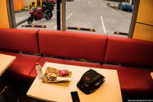
I approach Toowoomba later in the afternoon, stopping at a fast food location. I will only basically say, as politically correct as I can, that the type of patrons present at the stores had me wanting to leave Toowoomba as soon as possible. I resume my way towards the direction of Brisbane, until I approached the highway that would lead me to a kilometre of very impressive, smooth tarmac with one of the most beautiful backdrops to garner my attention.
Perplexed at the sight of such an unexpected scenery, I make it to Picnic Point Park, which lies on the eastern-most section of the city of Toowoomba. The park makes the most of its location on the edge of the Great Dividing Range, looking out to the rugged green terrain towards the direction of Brisbane. See through the slideshow above for an insight of the park.


Basic stats for the day:
- Rest stops: Hebel, Dirranbandi, St George, Moonie, Dalby, Toowoomba
- Kilometres travelled: 794kms
- Range of ambient temperature: 24°C to 35°C
To be continued…

Dave,
I note your point on motorcyclists and their reliance on the local merchants. Last century when I was a regular attendee at the Bathurst motorcycle races (and, so called, riots), while the police and their TRG chums might have decried some of the behavior of the motorcyclists, the locals loved them. Seems the car crowd who attended their races just hauled their booze, food, and anything else from their respective Sydney/Canberra/Melbourne suburbs. We motorcyclists on the other hand bought local. And did so happily. I like the idea of a 2 wheeled economic recovery in rural Australia!
Keep up the good work
Regards,
Al
LikeLiked by 1 person
I appreciate your response, Al! Great to know that the locals are in favour of riders. Everywhere I go, in fact, I am greeted by positive vibes. It’s probably because riding promotes positivity in the first place, and thereby making it contagious… everybody ends up being happy! 🙂
LikeLike
[…] Rain clouds forming… […]
LikeLike
[…] stopped over at Cooma to get a feed at a fast food chain. In one of my previous posts, I had made a call to support local shops when you are out travelling in regional areas, however I succumbed to the forces of corporate […]
LikeLike
[…] For now, I will complete the coverage of the Putty/Wollombi Loop that my riding group had completed the other weekend. I will only briefly go over the cafes that we had pulled over at, accompanied by the photos for the day. I feel that these places are a hugely important part of these remote areas, as I explain in one of my past blog posts. […]
LikeLike