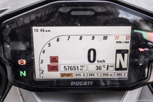
Day 20: Live update – Odometer 57996km. A change of landscape as I approach the Mt Isa and Cloncurry region of Queensland. So many outback photo opportunities out here, with the variety of hills, dried creeks, antique machineries and the constant stream of old 2WD cars participating in the annual Outback Car Trek… but I must move on. It’s still a bloody long road ahead.

Day 20 of my trip around Australia consisted of another day on the remote Barkly Highway. Difference for this day was the crossing of the NT/QLD border, which meant that the 130km/h of the Territory’s speed limit was reduced to Queensland’s comparatively paltry 110km/h. There was still a lot more to go before I reached the eastern coast of the Sunshine State. Until then, all that I would see consisted of sprawling acres of arid and isolated landscapes.


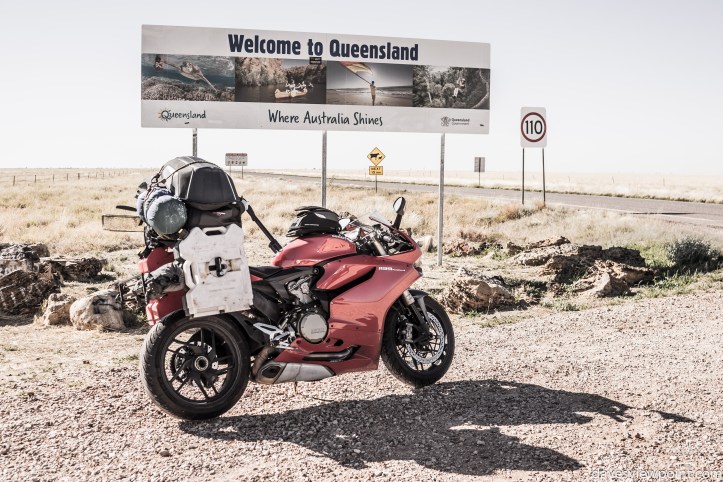
The first town across the border is Camooweal. With a permanent population of under 200, this is a very small town that relies on business derived from travellers and interstate truckers. The town is so far off from metropolitan centres that supplies such as fuel are marked up accordingly. Major commercial options are another 170km away at the industrial city of Mount Isa.


The previous night’s run was an ordeal of battling against swarms of small bugs and locusts. As seen below, the front fairing received a serious battering. Weeks of accumulated grim had also provided time for the grease and dirt to become ingrained on to the bike’s components.


There was no end to the radiant ambient heat of the outback. It was as steaming as the past week at Western Australia and the Northern Territory. With the lack of much tree cover, shade is at a premium out here. In contrast to the NT’s red dusted environment, this side of Queensland is an endless expanse of dry, golden fields.
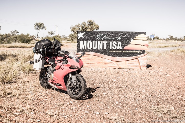
Mount Isa is the largest town in the Gulf Savannah region of Queensland. It’s a very significant industry for mining operations which has been ongoing for many decades since the 1930s, and shows no sign of it slowing down. Copper, lead, silver and zinc are the leading resources that are produced here.


Mount Isa is best observed from the city look out. This view point is located right in the heart of the outback city, affording 360-degree views of the whole town. A local favourite, it is both a tourist attraction as well as a scenic lunch spot for workers in the area.


The landscape to the east of Mount Isa transforms into shrubby hills and undulating terrain. Many examples of industrial-age machines are observable, a highlight for those who are interested in vintage artefacts.


I stopped by at Cloncurry, where lengthy lines of drivers were taking a break between their journey as part of the Outback Car Trek in support of the Royal Flying Doctor Service. A great variety of older cars were present, represented by brands to the like of Volvo and Datsun, although formations of Ford and Holden cars were the dominating scene.


The next stop after Cloncurry was Julia Creek, where I filled up on fuel right before the servo closed up for the night. At this point, the road becomes the Flinders Highway. This is where I also discovered an unattended shower room; an excellent opportunity to have a sneaky, well-deserved shower. I had to stem the trend of the past few nights without a proper shower and the availability of amenities further up the road was questionable. It was a good thing that I took advantage of such a chance and feel hygienic and civilised, ready to hit the darkened journey that awaited me for the remaining night.

Whilst others may dismiss the bleak vista of the outback, its barrenness is the very cornerstone that perpetually beckons me. The abundance of unhindered open spaces allow the mind to focus on the more important facets of life. Going back in time to when I had the world in my hands, and remembering the promises that I made to myself that somehow lost its way; the outback is my retreat where I can meditate within the realm of simplicity and be inspired to thrive. Indeed, there is beauty in simplicity.


Basic Statistics for the day:
- Route: Ranken, Camooweal, Mount Isa, Cloncurry, Maxwelton
- Total distance: 735km
- Range of temperature: 22°C to 38°C
Expenses for the day:

General map route:

